|
Trunnah |
|


The hamlet of Trunnah has been known by several names through the centuries:
1271: |
Truno |
Sometimes if the writer of the document was not familiar with the place and the person providing the information was illiterate, then places would be spelt as they sounded. In the cases above though, these spellings can be found in more than one document. The most common spelling is Trunnall which is used for centuries and continues until around 1881 when it appears on the census but changes to Trunnah by the 1891 census. It is quite easy to see how the spelling changed as the two versions sound very similar when spoken. The transition did not happen overnight however and both spellings can be found throughout the 19th century.
In 1841 it is mainly inhabited by agricultural labourers but by 1851 several Yeoman Farmers and trades people are noted. It does however seem to remain a mainly agricultural area. One resident in 1891, a Lighthouse Keeper, seems a little far from work though.
On the 1839 Tithe Map there is possible evidence of a previous Saxon village with Trunnah running along the outskirts, perhaps 'Truno' was originally a Saxon village. It could of course be even older still.
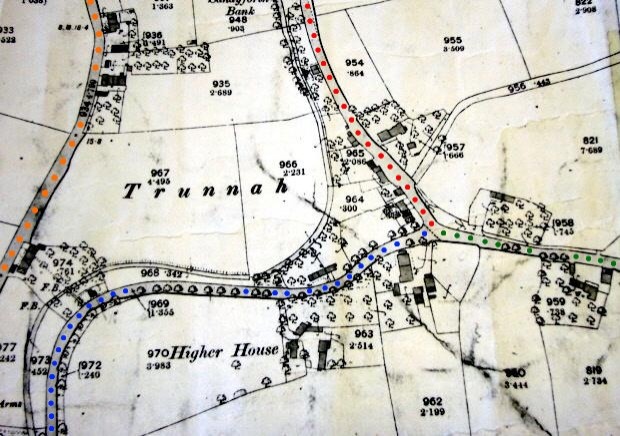
The roads shown on the map are as follows:
Orange |
* Fleetwood Road North |
* Modern Roads used as reference points